
In Summary
Data-led landscaping uses measurable, verifiable information to make better decisions about what to plant, how to manage it, and how to prove it's working. For commercial green spaces in 2026, that data is no longer optional.
Biodiversity Net Gain obligations, ESG reporting requirements, and tightening planning policy all demand evidence. This article explains what data is used, how it shapes design and maintenance, and what it looks like when Q&S puts it into practice.
Jump to:
- What is Data-Led Landscaping?
- Why Should Landscaping Become More Data-Led?
- What Data is Used in Landscaping?
- How Data Improves the First Stage of Landscaping Projects
- How Data Shapes Designs & Planting Plans
- How Data Supports Landscape Maintenance & Long-Term Management
- How Data Helps Biodiversity & ESG Reporting
- Q&S's Data-Led Approach in Practice
Good landscaping has always been rooted in good knowledge. Knowledge of plants, soil, seasons, and the site. The kind of understanding that takes years to build. At Q&S, that craft is the foundation of everything we do.
But we’re organic gardeners operating in the 21st century. We garden in a specific way. We favour traditional gardening practices, gardening by omission, removing artificial, chemical fertilisers and doing it smarter. In today’s green spaces, managing a commercial landscape on instinct and experience alone isn’t enough.
This article explores why data-led landscape asset management is becoming the gold standard for serious commercial green spaces in and around urban areas: the pressures driving it, the tools making it possible, and what it looks like in practice.
What Is Data-Led Landscaping?
Data-led landscaping changes everything. At its simplest, it’s the practice of using measurable, verifiable information to guide landscaping decisions: what to plant, where, in what substrate, how to manage it, how to manage the water it needs, and how to know whether it’s working.
That data might come from tree surveys, geospatial mapping, or ecological surveys capturing what’s already present on a site. From our acoustic monitoring tool, which records birds, insects, and pollinators – because hearing a site is as revealing as seeing it.
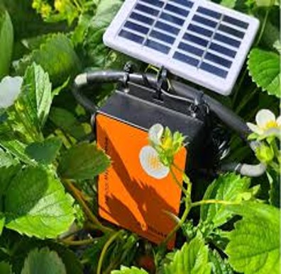
Or from Q&S’s bespoke in-house App, feeding data into the dashboard which logs a baseline, capturing everything from the weather, gardening tasks, completed checklists and photo evidence to showing us why a particular species might be doing brilliantly in a specific site. It also enhances diagnostic and reporting functionality. Combining maintenance data with ecological knowledge to inform decisions, making modern-day horticulture smarter than simply using the natural resources available. Because for effective insight-led landscaping, it’s about more than just the data you hold; it’s what you do with it and how that feeds into landscape design that makes a difference.

Why Should Landscaping Become More Data-Led?
Commercial green spaces have never faced more scrutiny, or more opportunity.
Regulatory Pressure
The regulatory landscape has shifted. Under the Environment Act 2021, most new developments must now demonstrate a minimum 10% Biodiversity Net Gain (BNG), meaning a site must be left in measurably better ecological shape than before. Without baseline data, there is nothing to measure that gain against. Without ongoing monitoring, there is no way to prove it has been achieved. Frameworks like the Urban Greening Factor and London Plan Policy G6 push the same agenda further still, setting the expectation that green spaces do more than exist. They must perform.
ESG and Proving Value to the Board
Clients face equal pressure to demonstrate return on investment in environmental and social value. ESG reporting is expected, and the teams responsible for it need to know they are sharing evidence that will stand up to scrutiny. Biodiversity targets, sustainability goals, risk management, and maintenance budgets all demand a more evidenced approach to landscape management.
Tree Risk and Liability
Trees are an ecological asset, whether on a business park or within a shopping complex, but they can also be a liability. Without accurate, up-to-date survey data, the condition of a tree and the risk it poses to people and property is largely unknown. Tools like web-based tree inventory platforms make tree data visible, geo-tagged, and always accessible to clients.
Powerful ecological tree survey tools give clients valuable insights into every tree on their estate. Beyond the numbers, these insights directly inform how trees are individually maintained and how natural habitats are created and harnessed for birds, insects and wildlife corridors for bats, improving the wider ecosystem as a whole.
What Data is Used in Landscaping?
Data-led landscape management doesn’t start with technology. It starts with understanding what’s actually on your site.
Before any planning decisions are made, maintenance plans written, or biodiversity targets set, you need a baseline. And setting the foundations for that baseline means garnering several layers of information.
Site Surveys
The most fundamental is the site survey. Typically, a landscape survey for a commercial site. In other words, a thorough assessment of the existing landscape: what’s growing there, what’s struggling, what’s been planted in the wrong place, and what the soil, drainage, and microclimate conditions are doing.
Dedicated Tree Surveys
For sites lucky enough to have trees, that needs to extend to a dedicated tree survey, where we log the species, size, condition, and location of every tree, using overlapping algorithms to calculate a rich dataset ideal for board-level ESG reporting. Insights like the carbon stored in each tree, oxygen produced, carbon sequestration, energy effects, aesthetic value, potential pest impacts, avoided run off, and air pollution levels. As well as geo-tagging each tree so it can be tracked, managed, planned for (Planned Preventative Maintenance) and reported on over time.
Geo-tagged Asset Inventory
Alongside that sits the geo-tagged asset inventory. Every element of your commercial landscape – from trees and planters to irrigation points, green roofs and habitat features – is mapped and recorded in one single accessible system. For large or complex sites, this kind of structured inventory makes proactive, not reactive, management possible.
After all, you can’t maintain what you don’t know is there.
Habitat and species surveys
Habitat and species surveys add the deeper ecological layer. To capture what’s living on a site – the insects, birds, pollinators, bats and bugs using it, the level of connectivity between green spaces and the habitats that already exist versus what could be created. At Q&S, this includes our in-house acoustic monitoring tool, which records the sounds of nature on a site over time. The presence of bees, birds, and insects is one of the most honest indicators of ecological health. Scientists are increasingly using ecoacoustics to assess the health of a biodiverse ecosystem. Hearing a site is as revealing as seeing it.
Last month, our Q&S gardeners recorded a pair of Great Tits looking after their brood in one of our bird boxes on the treeline behind The Land Security Group’s busy Cardinal Place in Victoria, London. Proof that Q&S’s organic gardening practices really work, as there must be sufficiently high levels of insect life around the site to sustain them.
Ecological Assessments
When it comes to Biodiversity Net Gain obligations, ecological assessments enable data to take progress a step further. They provide the structured, evidence-based analysis that planning authorities, the board, and sustainability teams need: an irrefutable record of what a site’s ecological baseline looks like, and a framework for measuring improvement against it.
Maintenance History
Maintenance history is enormously useful. Knowing what interventions have been made on a site, when, and with what result builds a picture of what works and what doesn’t – site by site. That history informs Planned Preventative Maintenance: a structured, forward-looking schedule that anticipates what a site will need (and what to budget in advance) rather than reacting once something’s gone wrong. Combined with real-time logging of work-flows, via a bespoke in-house platform, that landscape picture becomes a live, evolving record rather than a set of disconnected, constantly outdated spreadsheets.
Spatial Data & Mapping
Spatial data and mapping tie it all together neatly. GIS-based landscaping tools allow all of this information – surveys, inventories, ecological data, maintenance records – to be assessed in relation to one another and the wider environment. Mapping green corridors, identifying connectivity between habitats, understanding how a rooftop planting scheme relates to ground-level ecology nearby: this is where individual data points become genuine insight.
Performance & Outcome Measures
And of course, you’ve got performance and outcome measures. The most meaningful being biodiversity value, a score showing what a landscape contributes ecologically, to give the client evidence to use for ESG reporting, sustainability targets, and Biodiversity Action Plans.
Together, these inputs make a landscape legible and manageable. In ways that visual oversight alone never could.
Now, what would Capability Brown make of that?
How Data Improves the First Stage of Landscaping Projects
Good landscaping starts long before anything goes in the ground.
Before a single plant is chosen or a maintenance schedule written, the most valuable thing a landscape team can do is listen to a site. What’s already there? What’s thriving, and what isn’t? What wildlife has quietly moved in? What does the drainage do in heavy rain? Where are the constraints, and where are the opportunities?
Phase 1: Habitat Survey
At Q&S, we think and survey before we act. That means beginning every project with a Habitat Survey; a non-invasive assessment that evaluates existing flora, fauna, habitats, and wildlife presence across the site. Have bats found a roost? Are there hedgehogs, dormice, or protected bird species? Is there anything that could, if disturbed, have a negative impact on the wider ecosystem? This survey captures what’s there before anyone makes a decision about what to add.
Phase 2: Species-specific Surveys
Where the Phase 1 survey flags something worth investigating further, we move to Phase 2 species-specific surveys. We bring in trusted specialists for these – entomologists to assess soil structure and insect life, ecologists to survey current and potential wildlife, and tree specialists to evaluate health, risk and habitat value. Each one adds insights invisible to the naked eye on a standard site walk.
Biodiversity Evidence
All this data then flows into Q&S’s Biodiversity Intelligence Platform, which turns biodiversity management into measurable evidence. Data collected on a dashboard is combined with our ecological knowledge to ensure that every proposed, ongoing or completed project is individually modelled for the biodiversity it contributes to the wider estate. Evidence clients can use with confidence.
Biodiversity Action Plan
That information feeds directly into a Biodiversity Action Plan; a practical, evidence-based framework that sets out how the landscape will be managed and improved. And it goes further. Where works are planned, by Q&S or any other subcontractor, we issue Biodiversity Impact Assessments to ensure everyone involved understands the ecological consequences of what they’re doing before they do it. Permission is only granted once the assessment is complete.
How a site manages rainfall?
Drainage and water management are part of that early picture too. Understanding how a site handles rainfall, where water pools, where it drains too fast, where irrigation will be needed, shapes everything from species selection to the substrates we choose.
It’s also where data-led thinking pays off from day one. We use a commercial-grade IQ4 irrigation platform, far more hi-tech than just turning the sprinklers on and off! By using Evapotranspiration technology, it reads daily climate data – temperature, solar radiation, rainfall – and automatically calculates exactly how much water the landscape needs that day. No guesswork, no overwatering. Just the right amount of water, at the right time, adjusted as conditions change.
For commercial sites where water efficiency, drainage compliance and plant establishment all matter, that’s a significant advantage from the get-go.
The result is a first stage grounded in evidence, not assumption. Every design decision, every planting choice, every habitat feature has a rationale behind it.
Case Study - Landsec: London Workplace Portfolio
The Q&S ethos on re-defining urban horticulture allows us to be positively disruptive in an ethical, sustainable and biodiversity rich way that benefits the whole Workplace community – free from chemicals, single use plastics and petrol-fuelled machinery. Creating landscaping schemes that make a lasting positive contribution.
Aim: To create oases in Central London in line with Urban Greening Factor (UGF) Policy G6 of London Plan 2021.
Using baseline data to demonstrate:
| Annual KPI Score | 97.96% (Q&S’ average: 2025/2026) |
| Biodiversity | 30% increase in pollinator friendly planting, green roofs re-purposed as biodiversity havens (Wetland areas) aligning with Landsec’s Urban Greening programme, enhanced wildlife, new species identified (Great Tits nesting in Central London). |
| Creative Planting | Increase in sustainable planting palettes. |
| Own Grown | Greenhouse fresh produce planned, harvested and served straight to on-site café. |
| Social Value | Community outreach via volunteering, interactive walking routes, seminars, workshops & internships. |
How Data Shapes Designs and Planting Plans
Once you know what a site is doing, you can decide what you want it to do next.
Survey findings shape the landscape scheme at every level. Which species will thrive here, given the soil conditions, aspect, and microclimate? Where are the opportunities to strengthen biodiversity, and what constraints do we need to design around? How does this green space connect to the wider ecological network and our neighbouring communities?
These are questions that need data to answer accurately.
Choosing the Right Species
A planting scheme that looks beautiful on paper can fail within a season if it ignores what the site is telling you. Soil structure, drainage patterns, exposure, and the presence of existing species all affect the success of a scheme. Data-led landscape design puts that site-specific knowledge into the mix, so we choose plants that are resilient to the conditions. Not just the render.
Strengthening Biodiversity
Ecological survey findings reveal where habitat features will have the most impact: where a wildlife corridor can be created or extended, where pollinator planting will connect to an existing green space nearby, where a tree canopy gap offers an opportunity rather than a problem. Spatial data and geospatial mapping connect them visibly, turning individual planning decisions into part of a coherent ecological strategy.
Balancing Appearance and Resilience
Clients managing business parks, apartment blocks, shopping centres, and hospitals need green spaces that look considered and well-maintained. Beautifully designed, innovative, wildlife-rich and safe areas for contemplation and connection. They also need landscapes that can handle a time of excessive drought or conversely heavy rain, a period of reduced intervention, or a shift in maintenance budget. Data helps find that balance – identifying species and schemes that perform well visually and ecologically over the long term, rather than just on day one.
How Data Supports Landscape Maintenance and Long-Term Management
Once a green space is established, the information gathered during surveys and installation serves as the foundation for everything that follows.
Asset Inventories and Tree Management
Site records and geo-tagged asset inventories tell maintenance teams exactly what they’re managing: where every tree sits, what condition it was in at last inspection, what maintenance it’s due, and what it would cost to replace if it were lost. That last point matters. Being able to budget accurately for tree replacement isn’t just practical; it protects clients from unexpected costs and helps asset managers plan with confidence.
Planned Preventative Maintenance
Data allows teams to anticipate when problems might arise. Pruning cycles, replacement schedules, seasonal interventions, all planned around what the site actually needs, informed by its history and monitored over time.
Real-Time Management with QServe
Our in-house management dashboard is where much of it comes together. Tasks, photos, completed checklists, and site observations are all logged in real time, keeping maintenance teams connected and clients informed. But it’s more than task management. QServe collects environmental data, from species performance to site-specific conditions, so that over time the platform builds a picture of what each site responds to and why.
Smarter Use of Natural Resources
That real-time insight is valuable for managing natural resources too. Take irrigation. Rather than watering on a fixed schedule, data from QServe and site monitoring means water is used where and when it’s needed. No more. With SuDS (Sustainable Drainage Systems) requirements tightening and watering a precious resource on everything from ground-level planting to rooftop terraces, that kind of informed, responsive management is no longer a nice-to-have.
The goal, as our MD puts it, is to future-proof these green spaces for generations to come. Not to stand still, but to keep moving in the right direction. And data is what tells us whether we are.
How Data Helps Biodiversity and ESG Reporting
For many of our clients, the pressure to demonstrate environmental impact is only growing.
Boards want to see evidence. Investors expect metrics. Planning authorities require proof. Good intentions and a well-maintained landscape aren’t enough on their own.
Data is what turns environmental action into something measurable and reportable.
Evidencing Biodiversity Net Gain
Biodiversity Net Gain requires a verified baseline; without one, there’s nothing to measure gain against, and without ongoing monitoring, there’s no way to demonstrate progress. The ecological surveys, habitat assessments, and species data gathered over a project’s life create exactly that audit trail: from what a site looked like before intervention, to what it’s delivering now.
Biodiversity Action Plans and Ecological Tree Surveys
For larger sites, Q&S builds this into a full Biodiversity Action Plan, a live, evidence-based framework that tracks ecological performance over time. Combined with our Ecological Tree Survey Tool – which calculates carbon storage, oxygen production, air pollution reduction, and habitat value tree by tree – it gives our clients board-level data that supports their sustainability goals, community relations, and risk reporting simultaneously.
Q&S’s Data-Led Approach in Practice
Data-led landscaping represents a significant shift in what commercial green space management can achieve. Done thoughtfully, it becomes a measurable contribution to a wider sustainability strategy, and increasingly, a conversation happening at board level.
At Q&S, that conversation is backed by evidence. Our approach combines horticultural expertise with organic, chemical-free and petrol-free practices, ecological data, and the kind of long-term thinking that turns a maintained landscape into a performing one.
The clearest proof of that is Fidelity International's Kingswood Fields campus. 28 acres of business campus, green space, and ancient woodland. After 18 months of evidence-led, organic landscape management, Fidelity became the first financial organisation in the UK to achieve the Wildlife Trusts' Biodiversity Benchmark: the ISO equivalent standard for biodiversity. The only standard in the UK that certifies excellence in continual biodiversity protection and improvement across their estate.
As Managing Director Sue Payne put it: "Commercial and biodiversity interests can live harmoniously together, with mutual benefits."
Data is how you prove it.
Frequently Asked Questions
-
What is data-led landscaping?
Data-led landscaping is the practice of using measurable, verifiable information to guide landscape management decisions: what to plant, where to plant it, how to maintain it, and how to prove it is working. At Q&S, it does not replace horticultural expertise - it strengthens it with evidence, making every decision more defensible and every outcome more measurable.
-
What is Biodiversity Net Gain and how do I demonstrate it?
Biodiversity Net Gain (BNG) is a legal requirement under the Environment Act 2021, obliging most new developments to leave a site in at least 10% better ecological condition than before. Demonstrating it requires a verified ecological baseline taken before any works begin, followed by ongoing monitoring to evidence improvement over time. Without that data, there is nothing to measure gain against.
-
What data is used in commercial landscape management?
Commercial landscape management draws on several data sources: site and tree surveys, geo-tagged asset inventories, habitat and species assessments, maintenance history, spatial mapping, and performance measures. Together, these inputs give landscape teams and their clients a complete, evidence-based picture of what a site contains, how it is performing, and what it needs next.
-
What is a Biodiversity Action Plan?
A Biodiversity Action Plan (BAP) is a structured, evidence-based framework that sets out how a site's ecological value will be managed and improved over time. For commercial sites, it provides planning authorities, sustainability teams, and boards with a clear record of ecological baseline, targeted actions, and measurable progress. Q&S develops Biodiversity Action Plans for larger commercial sites as part of an ongoing, data-led management programme.
-
How can landscaping support ESG reporting?
Landscaping supports ESG reporting by generating measurable, auditable evidence of environmental performance. This includes ecological surveys establishing a biodiversity baseline, ongoing monitoring demonstrating improvement, tree surveys calculating carbon storage and air quality benefits, and biodiversity scores that translate landscape management into board-level metrics
-
How do I evidence biodiversity improvements for a planning authority?
Planning authorities require structured, verifiable evidence of biodiversity improvement, not anecdotal accounts of good management. That means establishing a documented ecological baseline before any works begin, conducting species and habitat surveys at regular intervals, and maintaining an auditable record of interventions and outcomes. Q&S provides this through ecological assessments, Biodiversity Action Plans, and ongoing monitoring, creating an evidence trail that satisfies planning conditions and supports Biodiversity Net Gain obligations.
Talk to Us About Your Project
If you manage a commercial green space and want to understand what more you can achieve from it, we’d love to hear from you. Whether that’s a site survey, a biodiversity improvement plan, or a conversation about long-term landscape asset management – the Q&S team are here and ready to help.
